TOGETHER
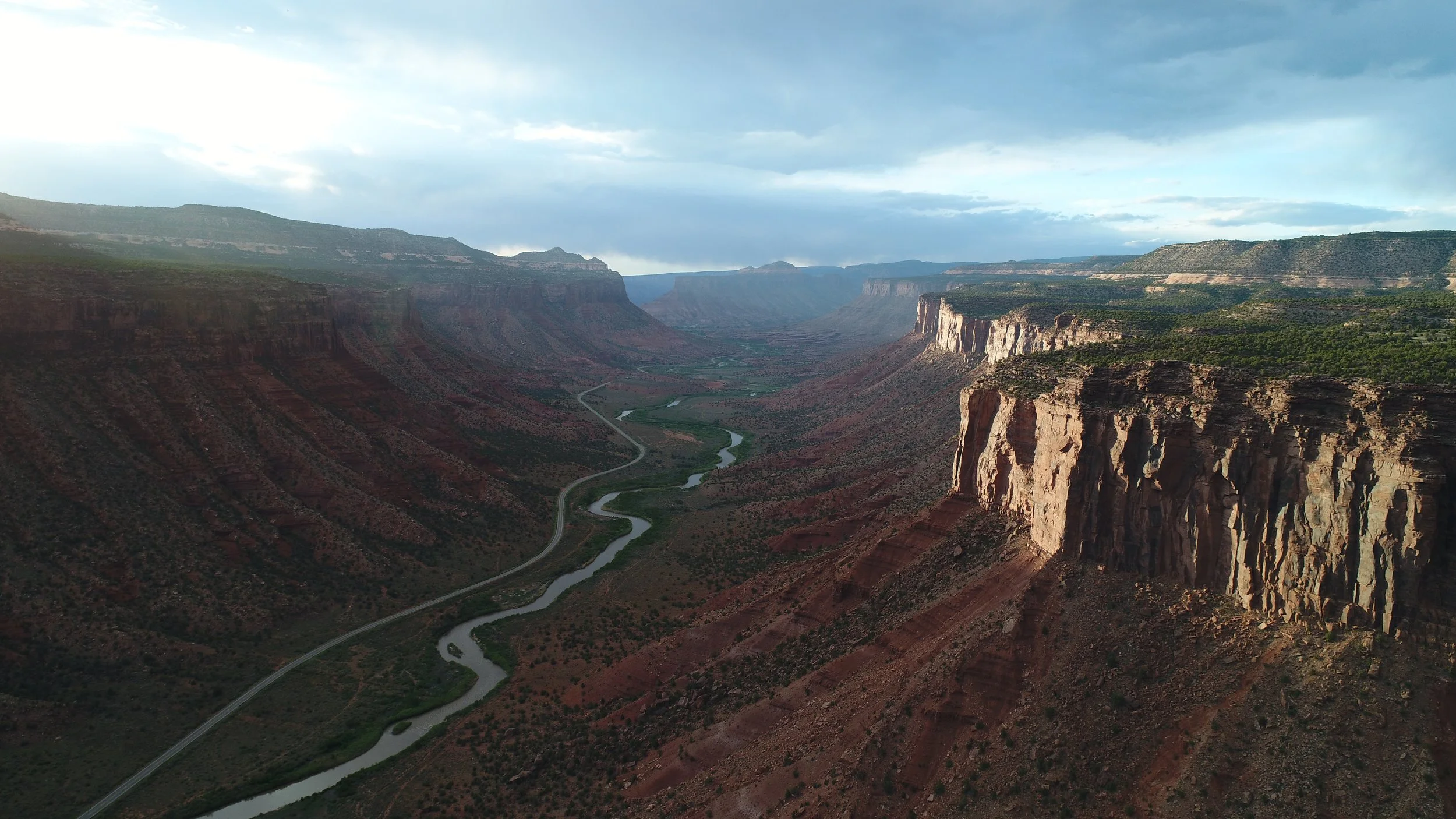
The Dolores Canyons is Colorado’s largest and most biodiverse stretch of unprotected public lands.
We are a coalition of conservation organizations, community groups, and businesses proposing the conservation of public lands in Western Colorado. We are advocating for permanent protections for the Dolores River Canyons from McPhee Reservoir to the Colorado and Utah state line. We are a strong and united voice, which is what it will take to protect and conserve the Dolores Canyons for future generations.
These public lands span western Colorado’s remarkable high desert ecosystems and are home to a rich array of wildlife, cultural resources, and outdoor recreation opportunities. A national monument or national conservation area in Mesa and Montrose counties would complement the pending national conservation area legislation in Montezuma, Dolores, and San Miguel counties to protect the entirety of the Dolores River Canyon Country.
WHY PROTECT THE
DOLORES CANYONS?

Rich Wildlife
The Dolores Canyons spans the state's largest and most biodiverse stretch of unprotected public lands, vital for native fish, rare plants, and iconic big game. Conservation would protect crucial migration corridors and winter habitats for deer and elk.

Mining History
Historic sites in the Dolores Canyons highlight Colorado's mining legacy, crucial for medical research and WWII efforts. The region provided radium for Marie Curie and vanadium for the Manhattan Project.

Cultural Resources
Indigenous communities, including the Ute Tribes, have deep-rooted cultural connections to the Dolores River Canyons region. Protecting the area honors and upholds their longstanding ties and cultural heritage.

Fossil Insights
The Dolores River region's sedimentary rocks from the Mesozoic Era hold marine and dinosaur fossils. These fossils provide insights into life's evolution and environmental changes during that period in Earth’s history.

Access to Recreation
Protecting public lands ensures future generations can continue to enjoy camping, boating, hunting, and hiking in the area. Today, the Dolores Canyons offers diverse adventures like rafting, biking, and off-roading.

Water Resources
The largely undeveloped public lands of the Dolores River watershed contribute to the health of the Colorado River. This benefits some 40 million Americans by improving water quality in the Colorado River system.
Today, the future integrity of the Dolores River Canyon Country is uncertain—imperiled by the long-term impacts of climate change, mining exploration, unplanned recreation, attempts to sell federal lands or transfer them to states, and development pressures. Permanent protections would provide a once-in-a-lifetime opportunity to plan for a future with climate uncertainty, identify better management strategies and infrastructure, and protect critical areas on the landscape.
Rejuvenated efforts to sell-off federal lands would be devastating for the Dolores Canyons and all unprotected public lands in the United States.
While the region has a long and globally-significant history of mining, we believe mining and other energy development isn’t appropriate everywhere. Future protections must strike a balance between protecting the most biologically- and culturally-rich public lands in the area.
Permanent protections must ensure that these public lands are managed in a manner that prioritizes the conservation of biodiversity, creates opportunities for local input, balances the needs of protecting nature and sustaining local economies, and preserves public access for recreation and traditional uses like hunting and grazing.
Join us in calling on Colorado’s elected leaders to permanently protect these lands.
We are advocating for permenent protections for the Dolores Canyons that:
Would honor private property rights, access, and existing water rights.
Would leverage resources to support ongoing efforts to restore degraded wildlife and riparian habitats, improve water quality, protect cultural resources, reclaim and clean up abandoned mine sites, and develop sustainable recreational infrastructure.
Would safeguard wildlife habitat while maintaining public access for hunting. Colorado Parks and Wildlife would retain authority to manage wildlife.
Would celebrate and support access to economically important and high value motorized routes such as the Rimrocker Trail.
Would allow mountain biking and would not impede on current efforts to build out the Sawtooth, Naturita Flats, or Nucla area trail systems.
Would not become a National Park. These lands would continue to be managed by the agencies that do so now: the Bureau of Land Management and the US Forest Service.
Would not have entrance fees. Like the majority of BLM National Monuments across the west, Dolores Canyons would not charge fees for entrance.
Would not prohibit public lands ranching and grazing. The BLM and USFS would continue to manage as they see fit.
Would not impact the vast majority of valid existing mining claims and known mineral lodes. Valid existing mining claims within the boundaries would be honored.
Join the Movement
Get connected to conservation advocates and outdoor recreation leaders in your community.
Together, we hope to create a movement across Colorado and inspire action to permanently protect the Dolores River Canyon Country.